bluebee®: Mobile tracking
Companies operating on a large geographical scale (any scale that can be displayed on a map) equip their technicians with bluebee® (on mobile phones or tablets) and use bluebee® cloud as a central system for planning and managing their facilities and resources. Large Siveco clients such as property management companies like Changcheng Property Group or Green Property Management or retailers like Carrefour China have deployed the systems on hundreds of sites, managing thousands of technicians.
This month’s Tips & Tricks article features the mobile tracking functionality of bluebee® cloud.
With bluebee® mobile tracking, large field service organizations can track technician’s movements and activities on a map. Geographical coordinates are automatically captured by bluebee®, using the devices GPS (or mobile tower cell lookup when GPS signal is not available) or based on recorded actions (for example a non-compliance is reported on an equipment, which itself is geo-positioned in the central database).
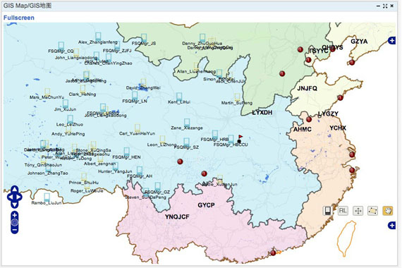
The screenshots below show a typical bluebee® cloud display, ideally on a giant touch-screen (the solution in multi-touch enabled) or on any Internet browsers (including tablet). Various display modes are available, for example showing current users position on the map. Zooming and layering functionalities are available, as part of bluebee® cloud embedded geographical module. The system can be setup so that icons representing users – here in the shape of a smartphone – can dynamically change color or shape depending on conditions (for example, technician on customer site, technician off duty, etc.).

bluebee® cloud mobile tracking allows the central team not only to track users, but most importantly to track their work: the map can display the location of HSE non-compliances, reported incidents, preventive maintenance work, etc. It can also be used to locate nearby technicians or facilities, to help optimize work.
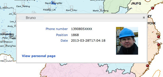
Clicking on a mobile user’s position icon brings additional information on the technician:

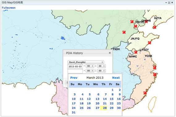
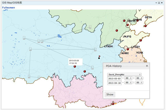
The route taken by a technician during a certain period of time can easily be visualized on the map, after selecting start and end time:


bluebee® cloud mobile tracking module opens endless possibilities to track and optimize field service activities and resources based on actual positioning of workers. It is a standard module of bluebee® and bluebee® cloud, which can be further configured to meet specific requirements of various industries and clients.
For more on how mobile tracking could apply to your business, feel free to contact us at info@sivecochina.com.


